
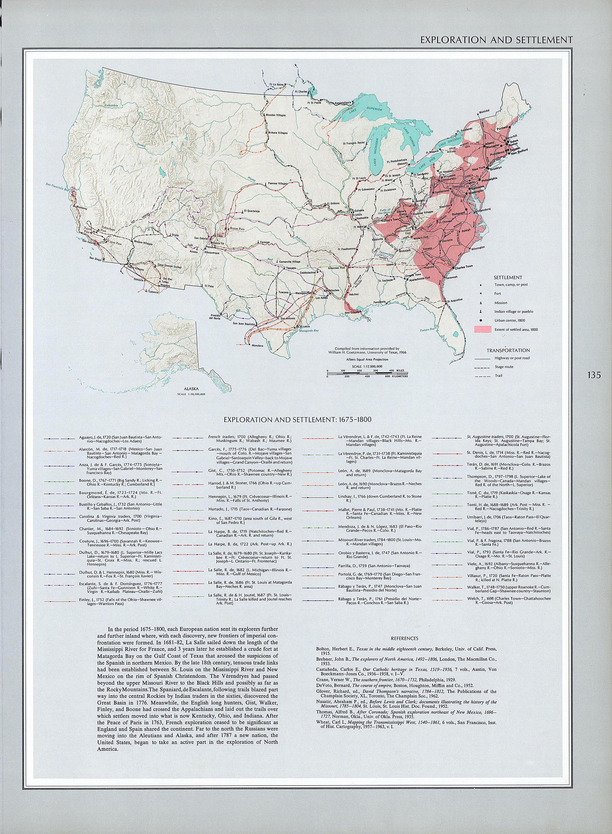
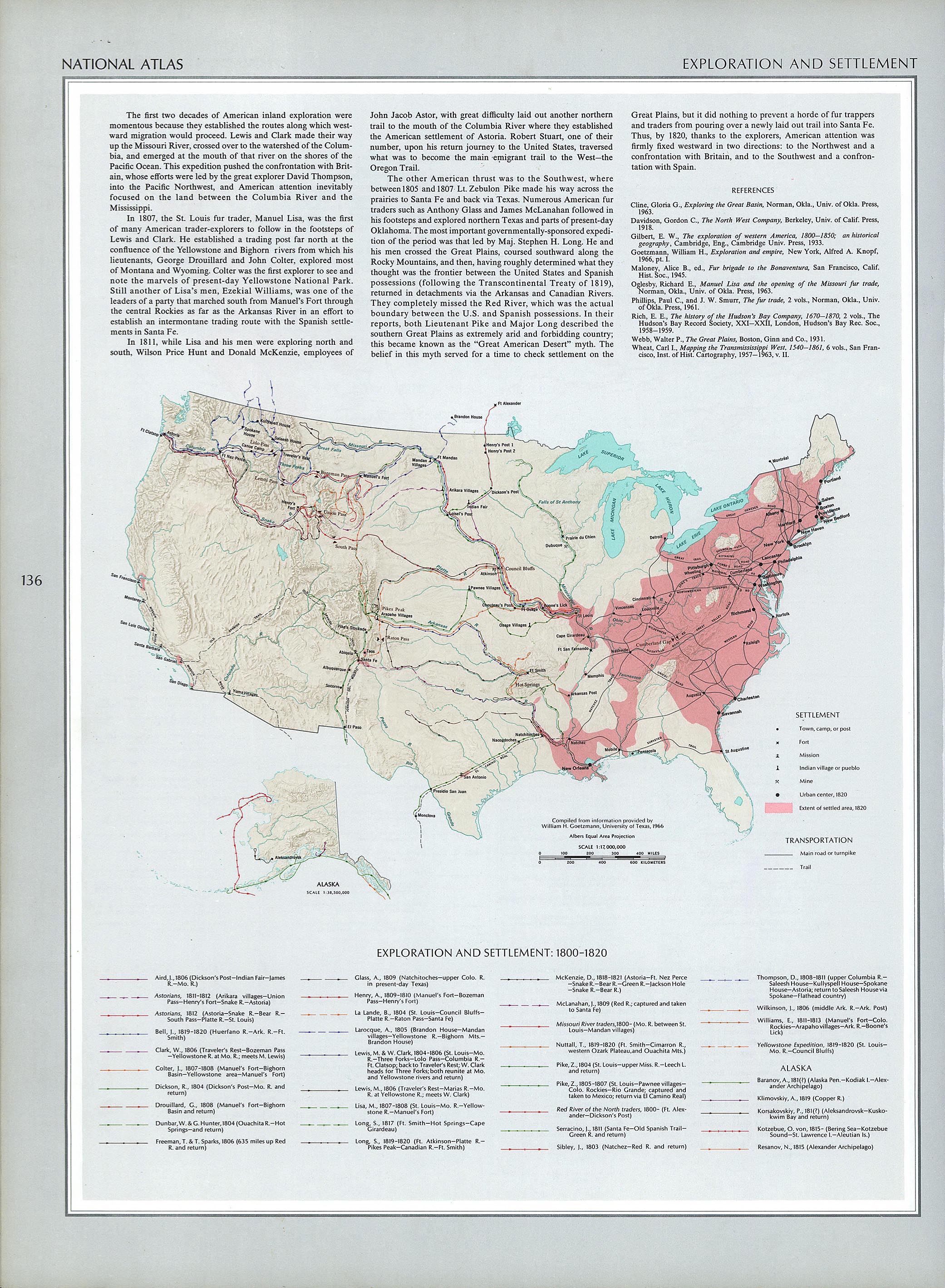
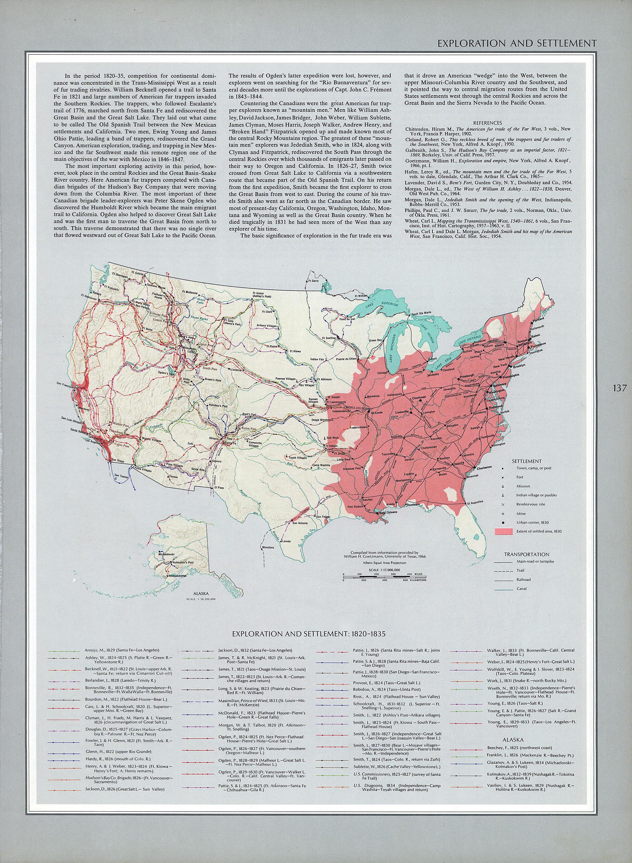
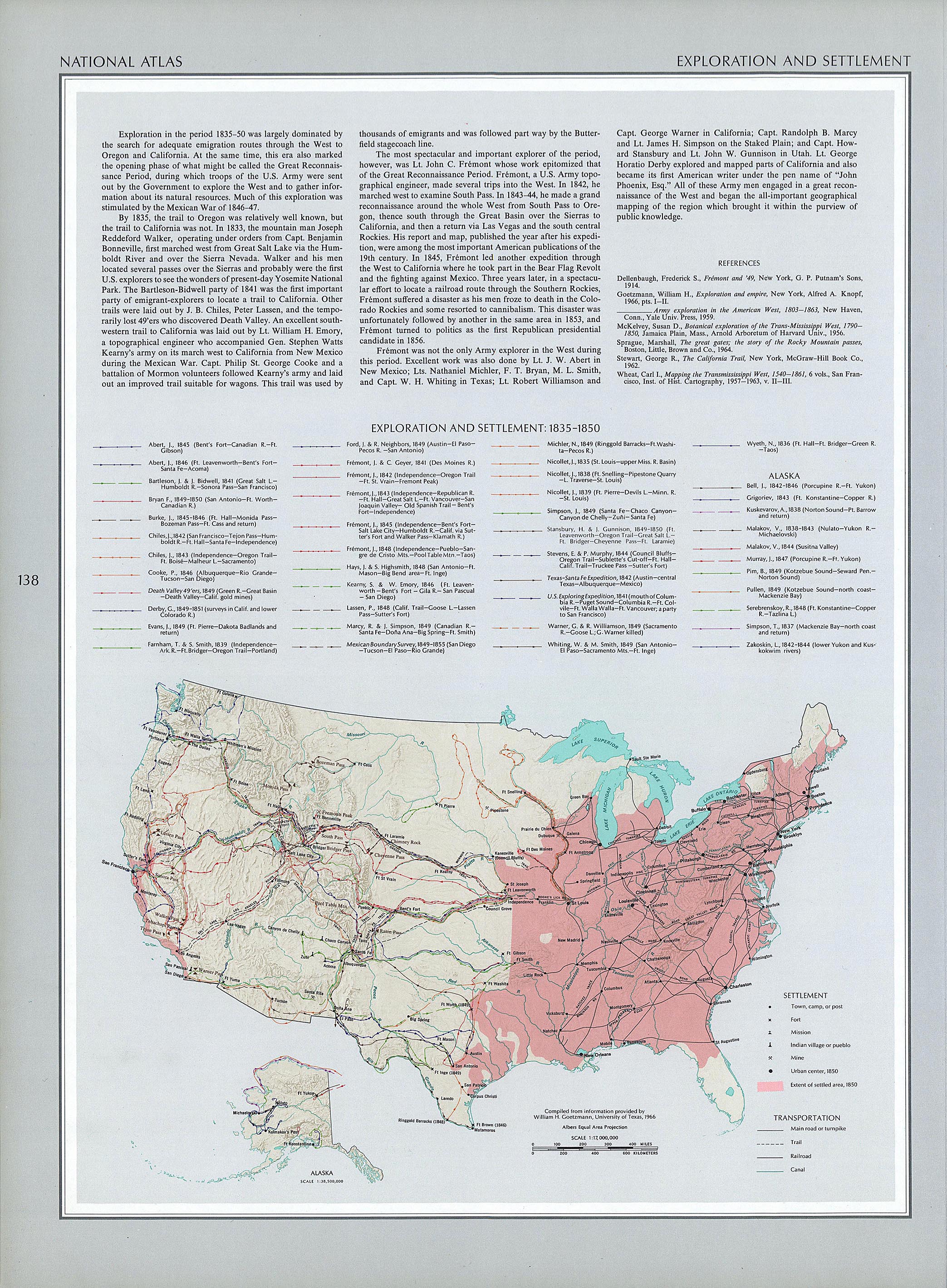
This map collection is very rich - go explore the Historical U.S. maps and see if one or more can help you understand migration trails of your ancestors. The exploration and settlement map for 1800 to 1820 is here, for 1820 to 1835 is here, for 1835 to 1850 is here, for 1850 to 1890 is here, etc. I find these types of maps fascinating. I open them in my photo viewer and magnify them so I can see the details of certain towns or states.
Does anybody know where Polypotamia and Pelisipia were in the 1783 to 1803 time frame? Check out this great territorial map of the United States.
I've always loved maps... I used to have a big collection of National Geographic maps from the 1930's on. With many maps on the Internet, the collection was downsized recently as we consolidate our stuff and remodel our house. I'm afraid that the Genealogy Cave is the next to be downsized... but not without my permission.
"Time sure flies when you're having fun. Where did this day go? What did I do? My genealogy pursuits were occasionally interrupted by Linda's luncheon party for her women's group". Love these words.
ReplyDeleteYour article is actually really clearly composed as well as easily understandable. Your current Blog theme is impressive as well! Would be awesome to discover exactly where My partner and i are able obtain it.Please keep up the excellent work.
ReplyDelete