One of the best parts of the day was riding in the car there and back because I could check out the city. My father drove, my mother rode shotgun, and my brothers and I were in the back seat usually with the windows down. San Diego grew significantly in the 1950s through the 1980s, and there was always something new to see along the way.
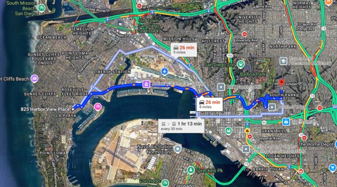
The map shows one route to their home (825 Harbor View Place in Point Loma) from our home (2119 30th Street) in South Park. That’s how we might go after 1970. Before the I-5 freeway through downtown was built, we would go this way:
- South on 30th Street to Date St.
- West on Date Street into Balboa Park along the Golf Course. I loved seeing the canyons we played in and the golf courses, and we went right by the Goloden Hill recreation center.
- North on 26th Street to Pershing Drive past the Naval Hospital.
- North on Florida Street to Zoo Place.
- West on Zoo Place to Park Blvd. There’s the Zoo! We went there often.
- West on El Prado to 6th Avenue where it turns into Laurel Street. This is the heart of Balboa Park with buildings from the 1915 and 1935 expositions, including museums and exhibitions.
- West on Laurel Street to Harbor Drive. First we had to go down the Laurel Street hill where you had to stop at the top and the bottom of the hill. The airport was at Pacific Highway and we could see planes taking off and landing.
- West on Harbor Drive to Scott Street. We drove past aircraft factories, a Coast Guard Station with seaplanes, the new airport as it was built, the Naval Training Center with a fake training ship, and then a yacht club.
- West on Scott Street to Talbot Street. Restaurants, bait shops, boat shops, small businesses. We could see out to Shelter Island.
- Northwest on Talbot Street to Harbor View Drive. Just three blocks.
- West on Harbor View Drive, then southwest on Harbor View Place to 825 Harbor View Place. Up a big hill and then down to the house.
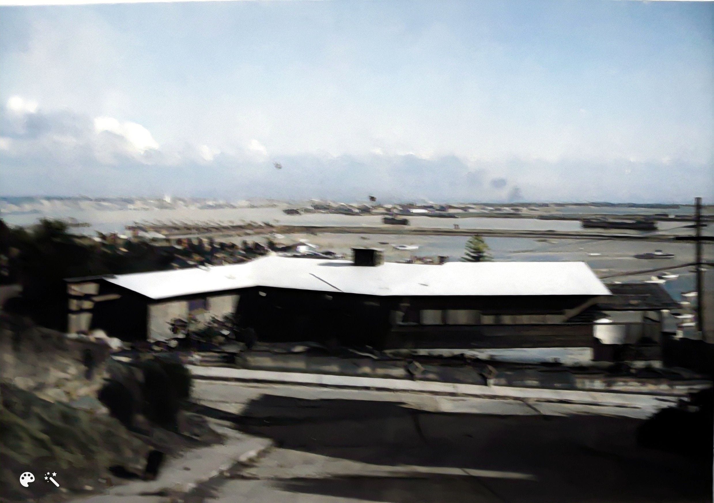
The view from the deck, the dining room, the living room, and bedrooms of the house was fantastic, clear to the mountains in the east, San Diego downtown, North Island of Coronado, the Silver Strand, Shelter Island, the beach along the bay, the yacht clubs, and ships on the Bay. My grandfather had binoculars and would point out all of the features to my young eyes.
It took about 30 minutes to drive each way. But the view was tremendous all through Balboa Park and along the Bayfront.
By the time I was 10 years old, I knew all of the major streets of San Diego from the Ocean to La Mesa on the east, an Mission Valley to the north, and had ridden my bike over most of them. I loved exploring. I still do. I love maps.
Oh, the memories of being a San Diego kid. More as time goes by.
Here is the same view from higher up on Lucinda Street in 2009 - Gram and Gramp's house is at the bottom of the hill:

=========================================
The URL for this post is: https://www.geneamusings.com/2025/04/monday-memories-going-to-gram-and.html
Copyright (c) 2025, Randall J. Seaver
Please comment on this post on the website by clicking the URL above and then the "Comments" link at the bottom of each post. Share your comments on Twitter, Facebook, or Pinterest using the icons below. Or contact me by email at randy.seaver@gmail.com. Note that all comments are moderated, and may not appear online immediately.
Please comment on this post on the website by clicking the URL above and then the "Comments" link at the bottom of each post. Share your comments on Twitter, Facebook, or Pinterest using the icons below. Or contact me by email at randy.seaver@gmail.com. Note that all comments are moderated, and may not appear online immediately.
Subscribe to receive a free daily email from Genea-Musings using www.Blogtrottr.com.
1 comment:
In 1973-74 I lived 3 streets away from your grandfather at 976 Scott St. I also lived in 2 other houses near there up on the hill overlooking San Diego Bay and the Kona Kai. Small world!
Post a Comment