Calling all Genea-Musings Fans:
It's Saturday Night again -
Time for some more Genealogy Fun!!

1) Do you collect maps of the places that you have ancestors or family? I do! I love maps. And have so many places!
2) Tell us about a recent map find for your genealogy and family history (it could be any time), and where you found it. Share the map and a comment on your own blog, or in a Facebook Status post, and share a link on this post.
Here's mine:
Facebook provides a lot of San Diego maps to me because I subscribe to several San Diego history and photograph groups. I also subscribe to a San Francisco Bay area group.
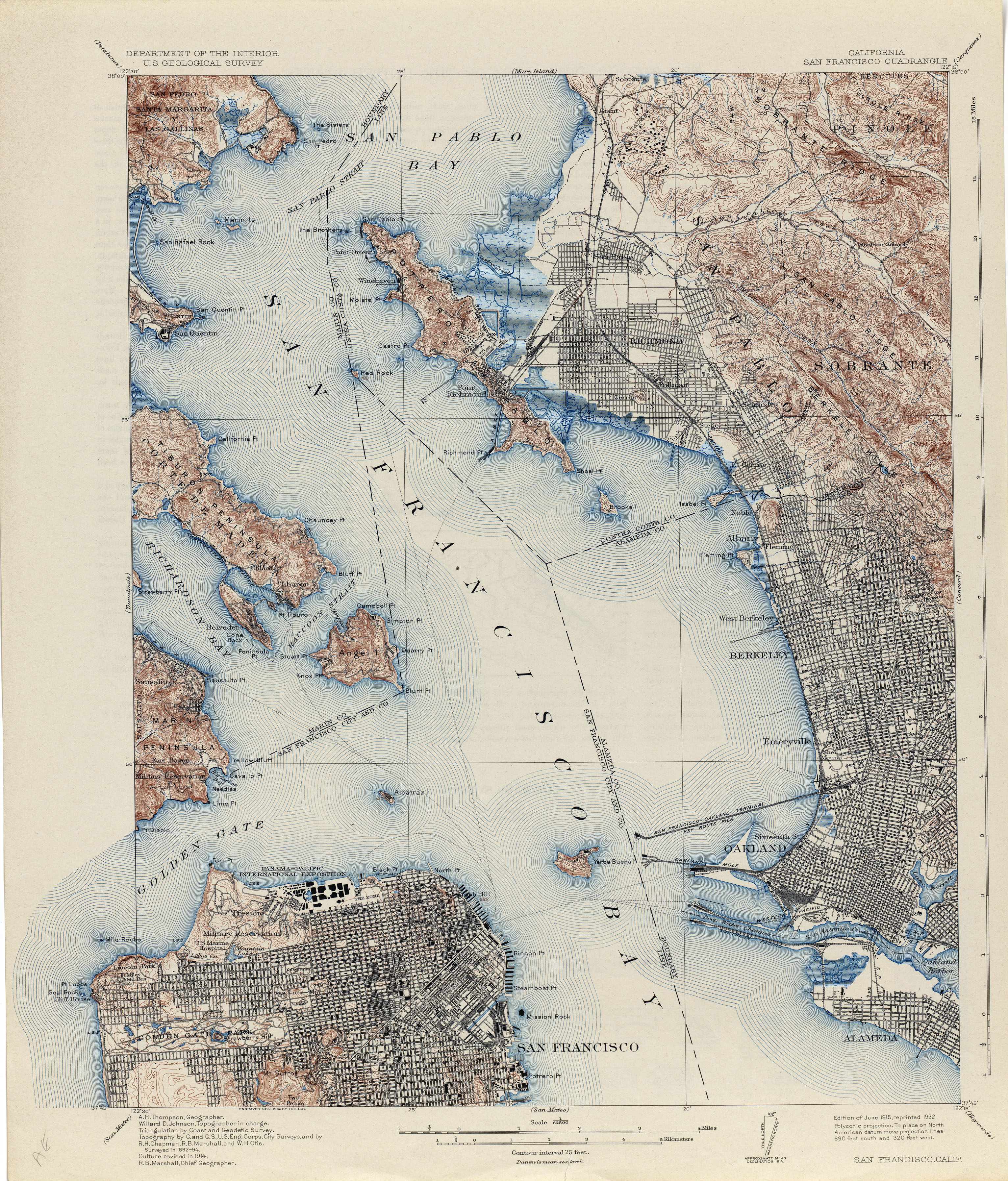
Here is a map that a San Francisco group shared on Facebook, obtained from https://maps.lib.utexas.edu/maps/topo/california/txu-pclmaps-topo-ca-san_francisco-1914-cop.2.jpg.

The 1915 map is before the bridges were built over San Francisco Bay and the Golden Gate. You can see which areas of the different cities were built up and which were still not settled. You can download the map and zoom in.
I checked out 1726 47th Avenue in San Francisco because that's where Linda's family lived. The streets were there along the ocean, but no buildings are shown along the streets. I also checked 4131 19th Street where the Elijah McKnew family was living, and no building was shown. I had to use Google Maps to figure out the street names. I also checked out 46 Rivoli Street where Linda's mother's family resided.
In San Diego, I recently found a 1944 street map of Chula Vista on a Facebook group:

Thie city was sparsely srttled before 1940, but Wortld War II caused a growth spurt to fill in housing between the major streets (every quarter mile). I don't think that the house at 577 Twin Oaks Avenue that my parents rented in 1942 is shown yet.
Recently, I saw this 1970 topographical map of the southwest part of San Diego County:

This really shows the river courses in green and zooming in shows the settled areas.
Maps are so cool!
==============================================
The URL for this post is: https://www.geneamusings.com/2024/07/saturday-night-genealogy-fun-what-maps.html
Copyright (c) 2024, Randall J. Seaver
Please comment on this post on the website by clicking the URL above and then the "Comments" link at the bottom of each post. Share it on Twitter, Facebook, or Pinterest using the icons below. Or contact me by email at randy.seaver@gmail.com.
Please comment on this post on the website by clicking the URL above and then the "Comments" link at the bottom of each post. Share it on Twitter, Facebook, or Pinterest using the icons below. Or contact me by email at randy.seaver@gmail.com.
4 comments:
Here's mine. https://diaocthongthai.com/en/map-of-lewis-county-kentucky/
My most recent map:
https://geneajournalsbyapearl.wordpress.com/2024/07/20/sngf-recently-found-maps/
I love the topo map, Randy! Here's my post:
http://www.ancestraldiscoveries.com/2024/07/saturday-night-genealogy-fun-what-maps.html
It appears I posted a link to one of the maps instead of my blog post.
https://mytrailsintothepast.blogspot.com/2024/07/sngf-what-maps-have-you-found-recently.html
Post a Comment